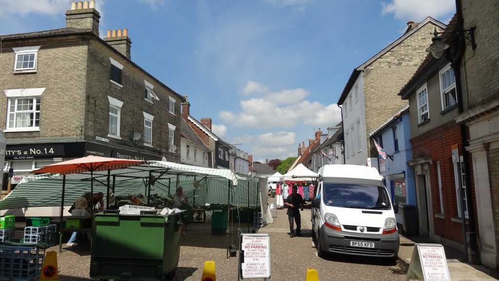
The traditional town centre
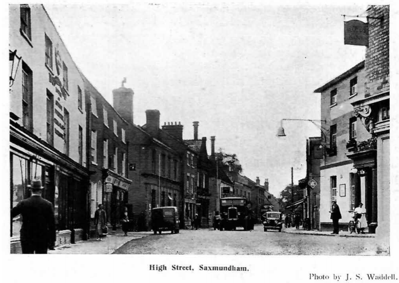
Photo from Official Guide to Saxmundham (1940), acknowledgment to Museum
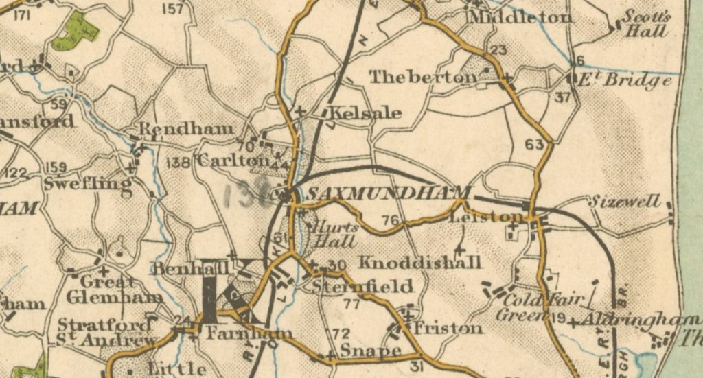
The main town grew up around the market and the cross-roads between the main Ipswich to Lowestoft route, and the smaller east-west road to Framlingham or Leiston. Some of the oldest buildings are in Chantry Road and South Entrance, with numerous buildings along and around the town centre (including Market Place) dating from the 16th to 18th century. The town centre is very largely contained within the present Conservation Area, for which a good report was made in 2016. This gives information on many interesting individual buildings, with photos. There is also a significant area of 19th century buildings – mainly dwellings but including the Congregational Church – to the immediate west of the centre, and close to the station.
The town trail also offers information on some sites of historic interest.
Although not part of the centre, Hurts Hall (to the south-east of town) has for centuries formed an important part of the town, its name as ‘manor” dating back to the Domesday Book, with successive houses built on the site. The latest dates to 1893, rebuilt following a fire; the house has recently (2021) been restored by its present owner. In his short history of Saxmundham, Richard Smith summarised its role:
“Hurts Hall is a neo-Elizabethan mansion of 1893, rebuilt after the elegant 1803 bow-fronted house by Samuel Wyatt was destroyed by fire in 1890. It was lately the home of the Long family, plantation and slave owners in Jamaica, who were nevertheless squires and benefactors to the town.”
One of the Long family’s contributions (from wealth so accumulated) was the elegant-fronted Market Hall in the High Street, founded in 1846 as a Corn Exchange, and later used as courtroom, drill-hall and public meeting place, as well as market.
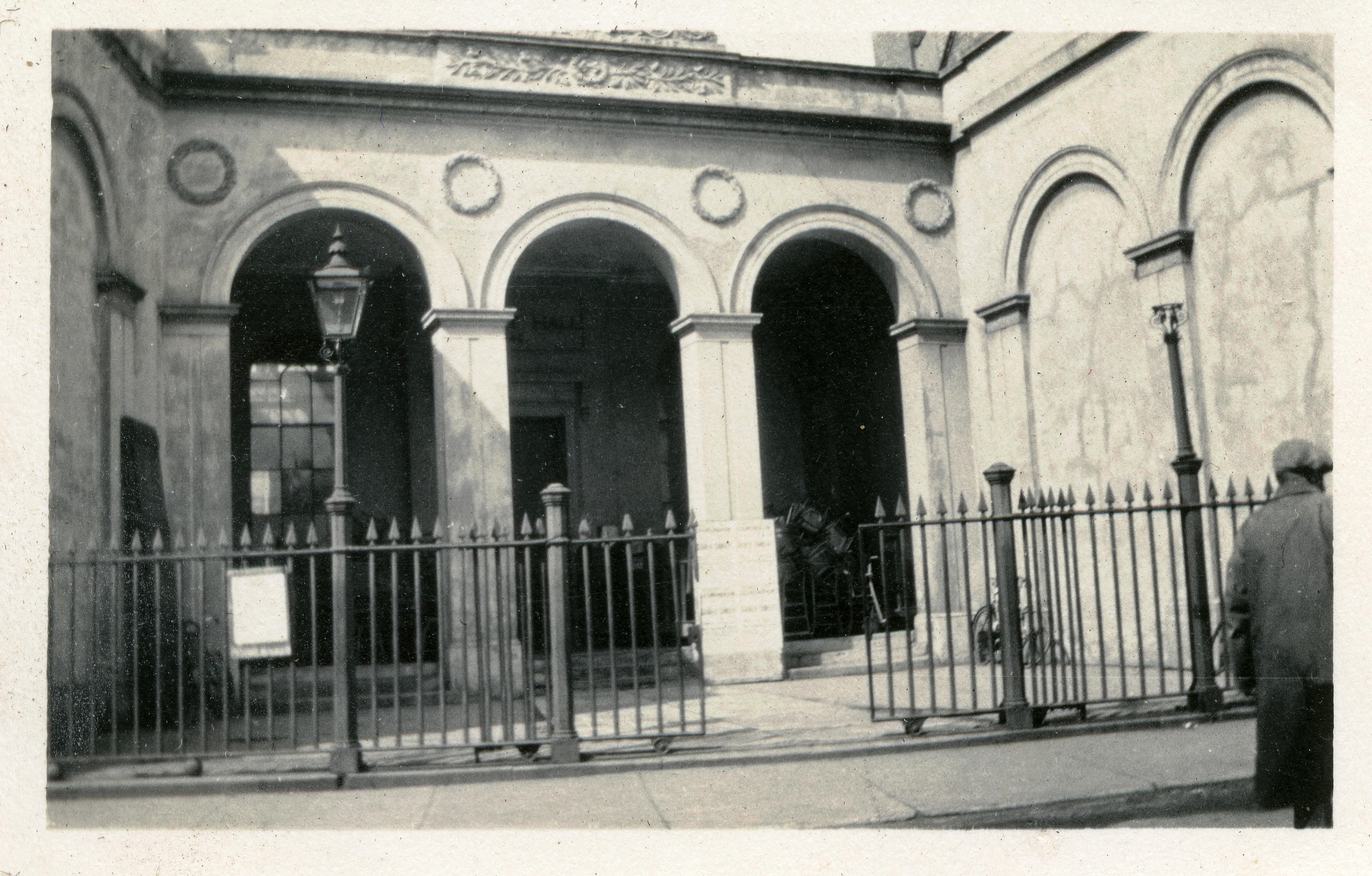
The Hall was transferred in 1920 to Saxmundham Urban District Council (now the Town Council) to hold on trust for use by the local community.
Population
For centuries, the population of Saxmundham could be counted in hundreds. In 1603, at the end of the reign of Queen Elizabeth I, there were just 113 adults recorded; by 1674 there were 96 households, which means a few hundred residents. Since 1801, a national census has been conducted every ten years (save in 1941), so we have more reliable figures to go by.
As the chart below shows, the population of Saxmundham grew at a steady rate for a century from 1801 through to 1901, and then saw some ups and downs in the first half of the 20th century. From 1950 it started to grow again, and from around 1980 has rapidly expanded.
In the 19th century, and much of the 20th, the rural population of Suffolk tended to diminish, but Saxmundham bucked that trend. In a study of East Suffolk rural change from 1850 to 1939, the author finds:
“The largest among several market towns was Woodbridge, with a population in 1851 of 5,161 falling to 4,734 in 1931. Of the other four market towns, Framlingham, Halesworth, Saxmundham and Wickham Market, only Halesworth had a population greater than 2,500 in 1851 (2,662), and only Saxmundham showed an overall increase in population over the whole period, of nearly twenty-two per cent. In contrast, the coastal towns of Southwold, Aldeburgh and Felixstowe expanded, reflecting their growing popularity as holiday and seaside resorts.”
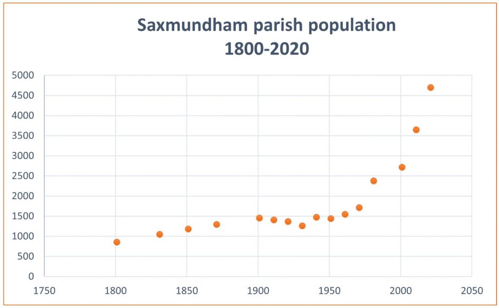
(All data are from the respective censuses, from 1801, other than for 1941 which is here a 1939 figure, and for 2021, where we use Office for National Statistics estimated population data for 2019)
The period since 1980 has seen the building of new housing estates – first, the Brook Farm Estate, to the west and north-west, and more recently, to the west but south of Rendham Road, and – to the east – the Hopkins estate. A South Saxmundham Garden Neighbourhood is included in the District Council’s Local Plan for the area, which would add around 2,200 to the population of the town (though much of it may be in Benhall parish)
Employment in Saxmundham
There is no space to analyse the changes in Saxmundham’s workforce over centuries, but this list of trades and crafts in 1844 (from Suffolk Heritage Explorer) paints a nice picture of the town’s life at that time:
“Post office, gardener/seedsman, gunmaker/game dealer, glove maker/glass dealer, cooper, cart owner, bookseller, police officer, bank agent, basket maker, currier/leather cutter, dyer, 2 farmers, tanner, 2 watchmakers, sheriff’s officer, attorney’s clerk, book−keeper, farm bailiff, bricklayer, coachmaker, upholstress, 3 gardeners, farrier/cow leech, land surveyor, auctioneer, cowkeeper, beerseller, fishmonger, corn miller/merchant, 2 bankers, 5 fire and life agents, 5 inns/taverns, 6 academics, 3 attorneys, 3 bakers/confectioners, 2 blacksmiths, 7 boot/shoemakers, 2 brazier/tinners, 2 brewers, 3 butchers, 3 cabinet makers, 2 chemist/druggists, 4 grocer/drapers, 3 laundresses, 2 ironmongers, 2 joiners, 4 milliners, 2 painters/plumber/glaziers, 2 saddlers, 2 shopkeepers, 2 stone masons, 4 straw hat makers, 4 surgeons, 3 tailor/drapers, 2 whitesmiths, 3 wine/spirit merchants”
From Poor Law to Local Government
Towns need to be cared for, developed and maintained. Residents need basic services to be provided. Roads, water, public health, looking after the poor, crime and security… But until the 19th century, the picture was complex as to who was responsible for what. The 1601 Elizabethan Poor Law had made each parish responsible for poor relief. According to a Parliamentary report in 1777, Saxmundham had a parish workhouse with accommodation for up to 60 inmates. This was situated along Rendham Road, not far from the Memorial Field today. Under the harsh New Poor Law Act of 1834, Poor Law responsibilities were given to the new Plomesgate Union, covering a wide area including Framlingham and Aldeburgh as well as Saxmundham. (Plomesgate was the name of one of the ancient “hundreds”, or divisions, of the county). A large new workhouse was built in Wickham Market – in the 1881 census, 4 out of 123 inmates were from Saxmundham, including a 5 year old boy.
In 1894, a new Plomesgate Rural District Council was formed in much the same area, which included Saxmundham until 1900, when Saxmundham Urban District Council (UDC) was carved out of it, to form a new unit of local self-government. The UDC managed many local services for the town, until it was in turn swept away in the reform of 1974. Its responsibilities were transferred in part to the new Suffolk Coastal District Council, and in lesser part to the Saxmundham Town Council.
In his ‘Official Guide to Saxmundham’ (published 1940), J.S Waddell said this of the UDC
“Thanks to a sympathetic, as well as progressive, Urban District Council, things ancient are well looked after and every opportunity seized to extend the modern. As an example, since 1934 [no] fewer than forty-eight Council houses have been erected, besides twelve by private enterprise and six by the Oddfellows Friendly Society…” [Editor: we assume the word ‘no’ was meant!]
Perhaps we should note, alongside these warm words, that the Guide was written for the UDC!
Since 1974, the Town Council (which is a parish council) owns and runs the Memorial Field, two playgrounds and the Market Hall, while most other local government tasks are divided between the county council (e.g. highways, social services, libraries) and the district council (e.g. planning, economic development, housing, waste collection and environmental services). The Town Council also supports local events and activities, and makes small grants to local voluntary bodies. It acts as the voice of the local community towards other levels of government and organisations on matters affecting the town.